We are back in the land of southern comfort food and humid temperatures. I love it!
Today, we decided to explore the Vicksburg battlegrounds and site of the famous siege that broke the Civil War. I’m a history nut and read a lot of histories. The Civil War has been a particular time period that I like to read about. Even Rich has read Shelby Foote’s “The Civil War.” That’s all three volumes, too.
I recently had created a family tree for our friend, Doug. It turns out that his third great grandfather fought in the Civil War at Shiloh and Vicksburg. Doug has an interesting family story about Michael Mason’s involvement in a crucial point of the siege. I would love to prove the legend for them. It would be a great research project.
In the meantime, we headed to the Vicksburg Military Park with the intention of finding the locations where the 1st Illinois Light Artillery Battery E would have been during the siege. Michael would have been at one of these locations.
It’s a 2 hour drive from Clarksdale down to Vicksburg. The road is pretty straight and extremely flat. This is all flood plain for the Mississippi River. The inhabitants just borrow it to grow cotton and soybeans. It’s harvest time out here right now. We see lots of large tractors and combines out picking the crops. It’s busy out here. You can tell where there is work because of the dust clouds that hang over the machinery.
Today’s temperature was going to be about 89 degrees. With the river close by, the humidity was also expected to run pretty high. The sun was beating down as we drove. By noon, we had turned on the air conditioning in the car again the humid, hot weather. A battlefield in these conditions would be a little bit of a challenge.
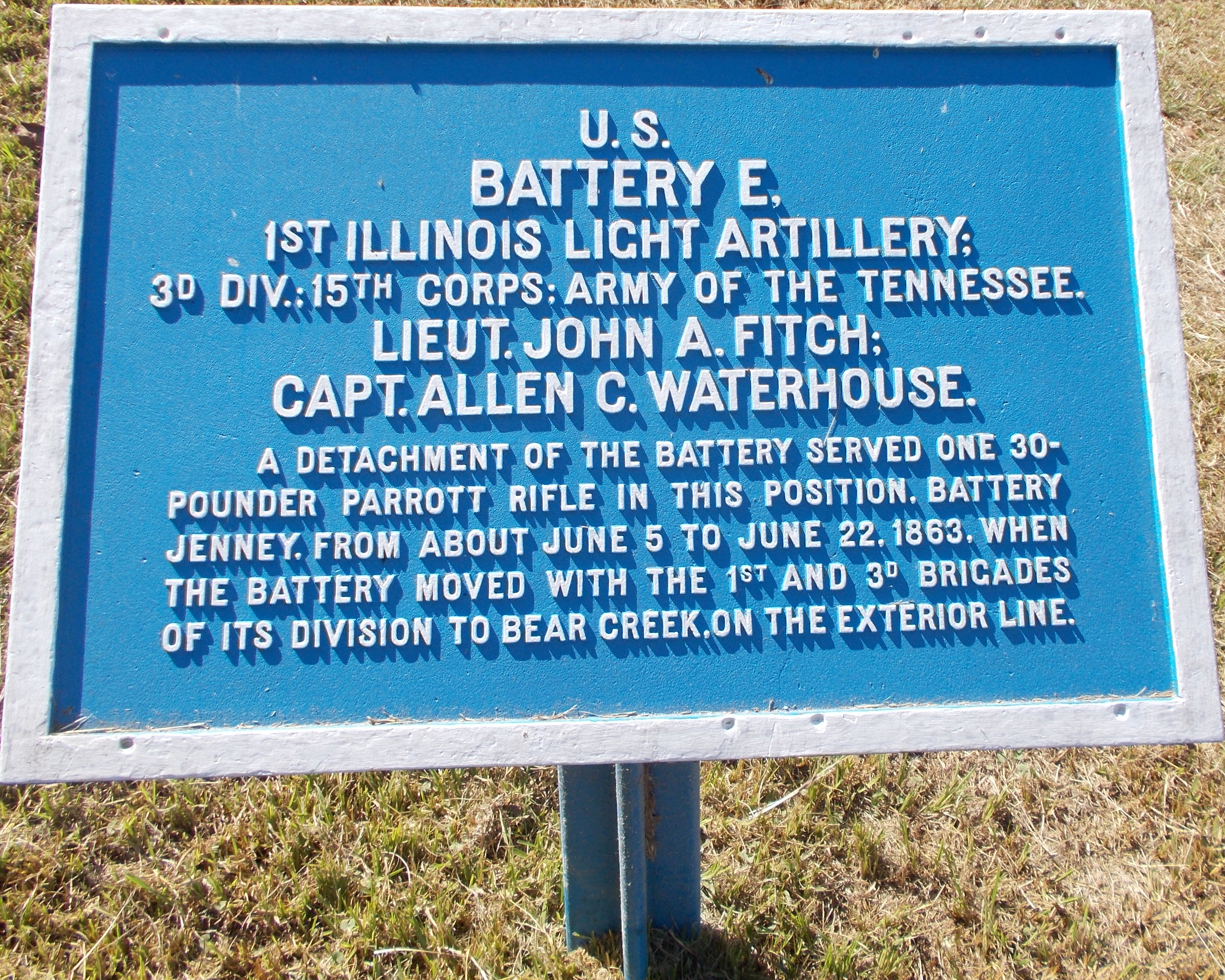
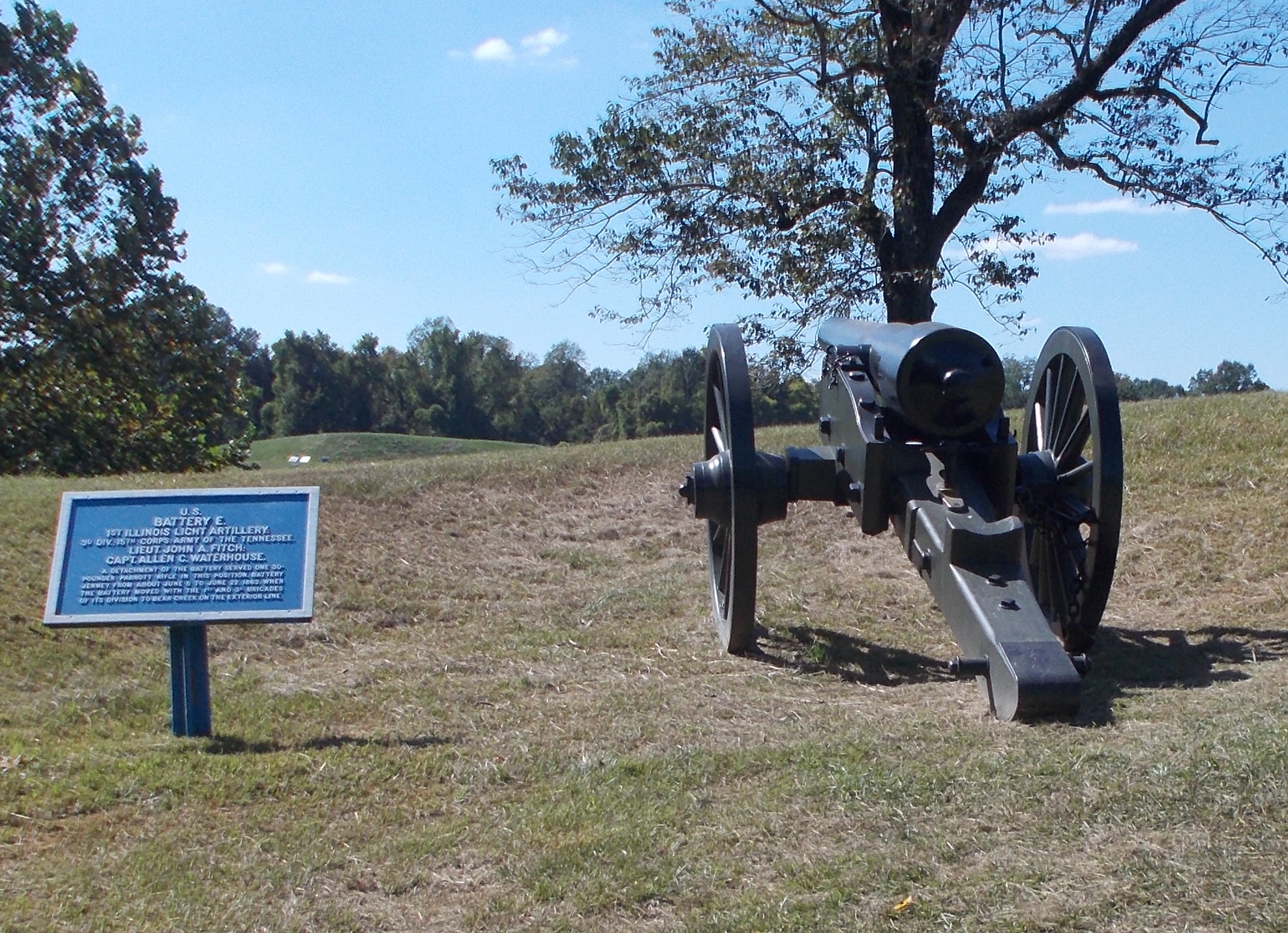
At the park visitor’s center, we stopped to talk to one of the rangers for more information. We got printouts for the regiment. A memorial stone to the regiment is located in the area where they were stationed. The ranger marked up the map for where three of the Union signs are to indicate Battery E’s locations. The Illinois state memorial is also marked on the map. Michael’s name appears on a roll of the Battery inside.the rotunda.
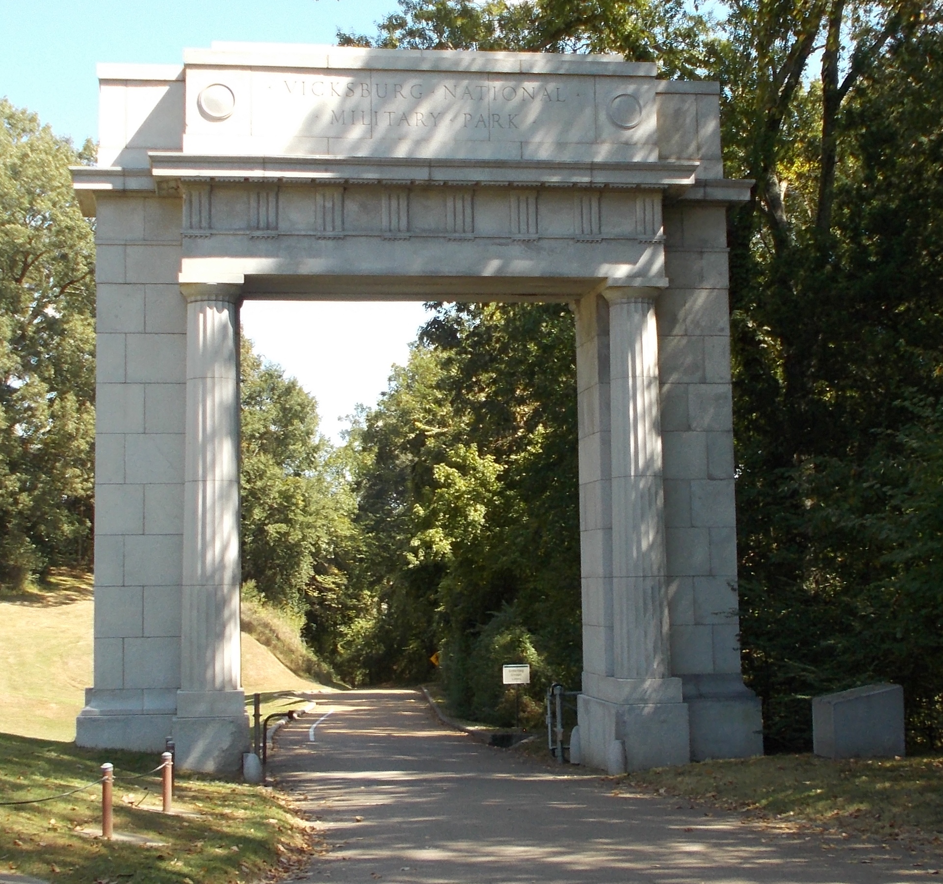
The park opens with a large military archway. The drive is through very hilly landscape with a lot of ravines. I can’t image trying to fight your way forward through this. Signs tell us that there were no trees in the area. The Confederate forces had stripped the landscape of anything that could be used to erect barriers against the advancing Union army.
Amazingly, there are pictures from the time period. There is not one tree or bush. There is barely any grass out there. The dusty dirty in the dry weather would have choked everything around it. In our pictures, it appears very lush. You just have to image the hills and dales totally bare of anything.
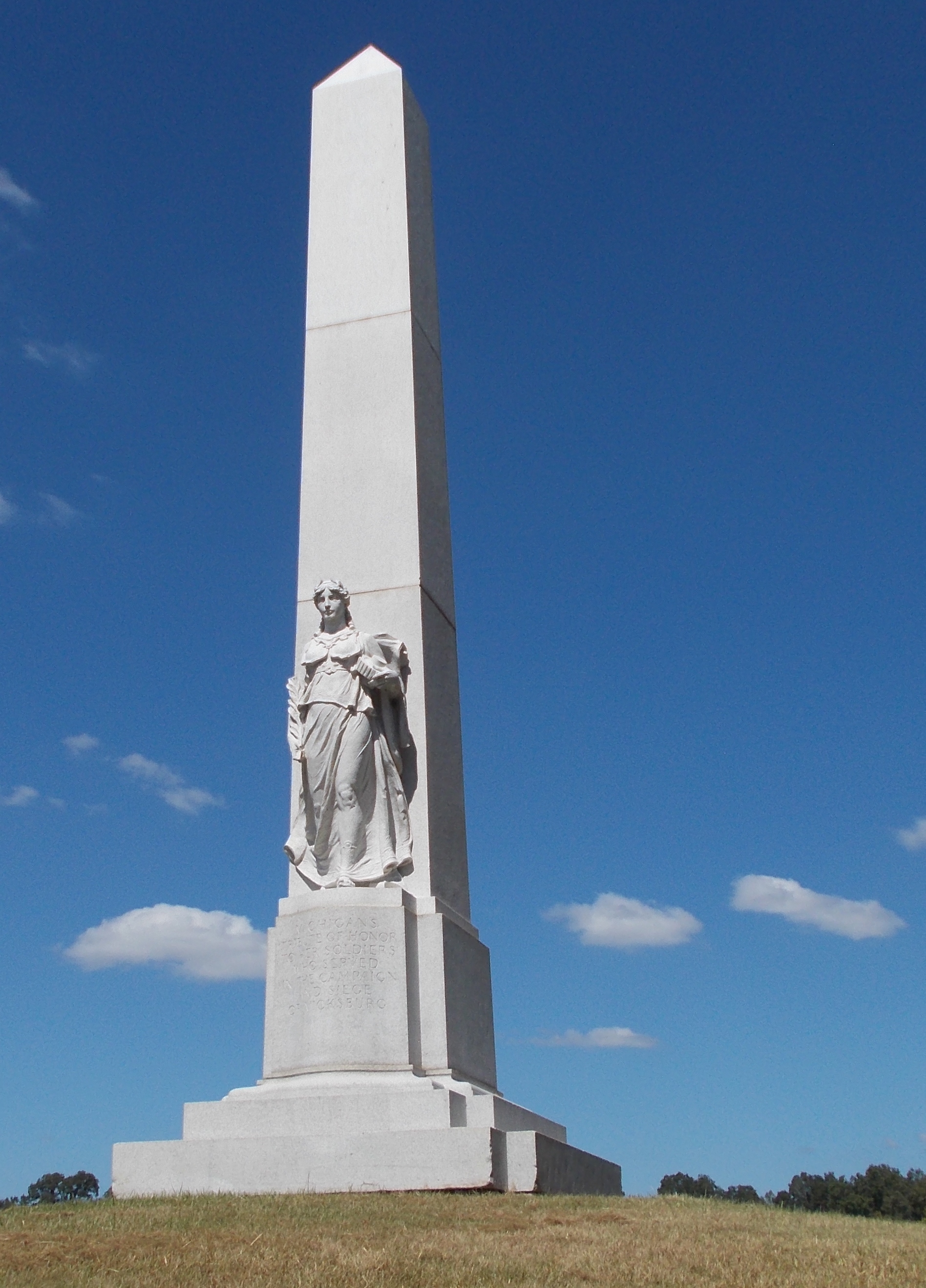
The drive winds through the Union lines with the various regiments from each of the states involved. We see Wisconsin, Illinois, Ohio, Indiana, Michigan, Iowa, Kentucky and several more. We make sure to stop at the Michigan monument. With the blue skies as a background, it is a beautiful memorial to the lives put on the line and those that were lost in service.
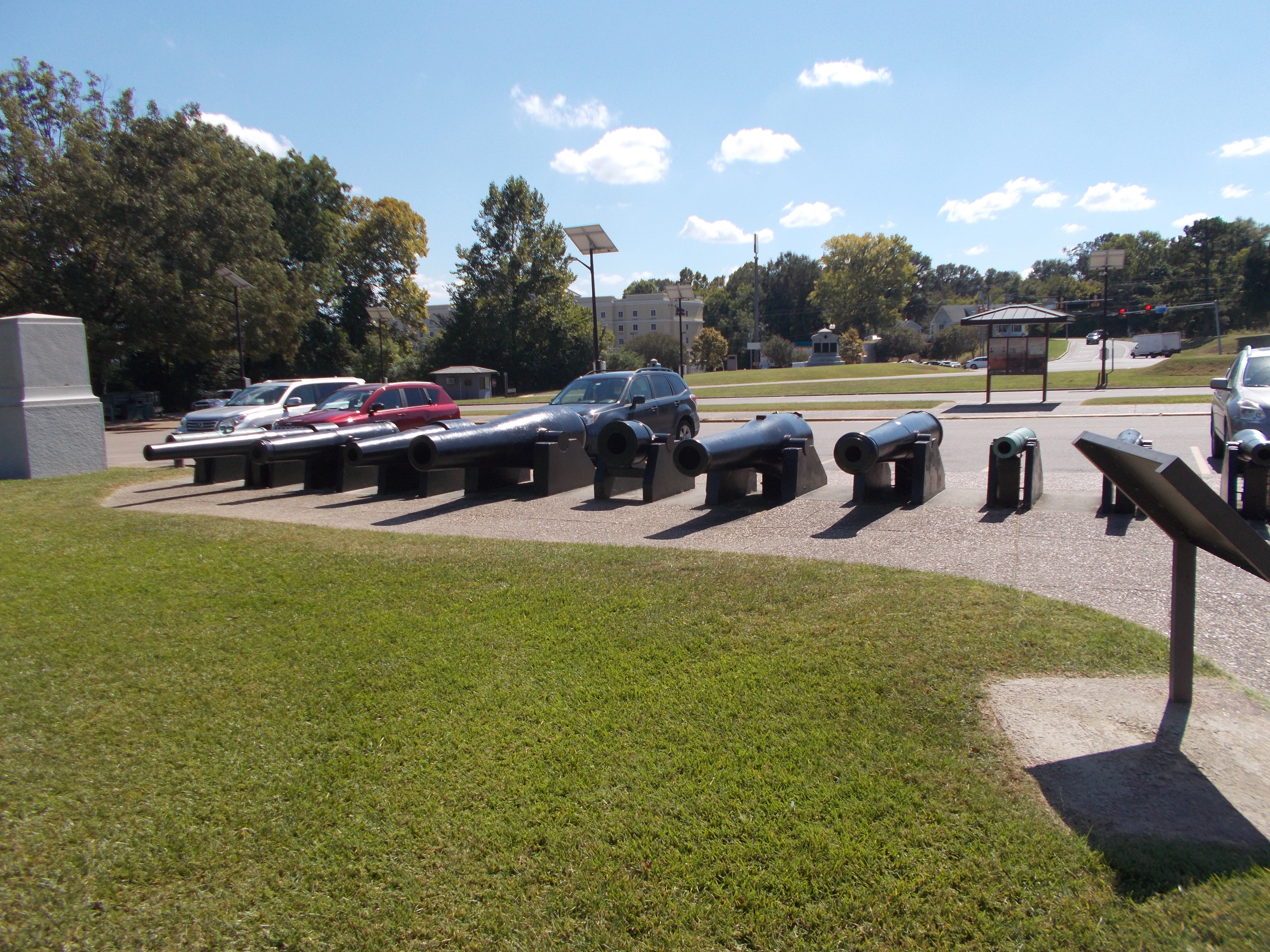
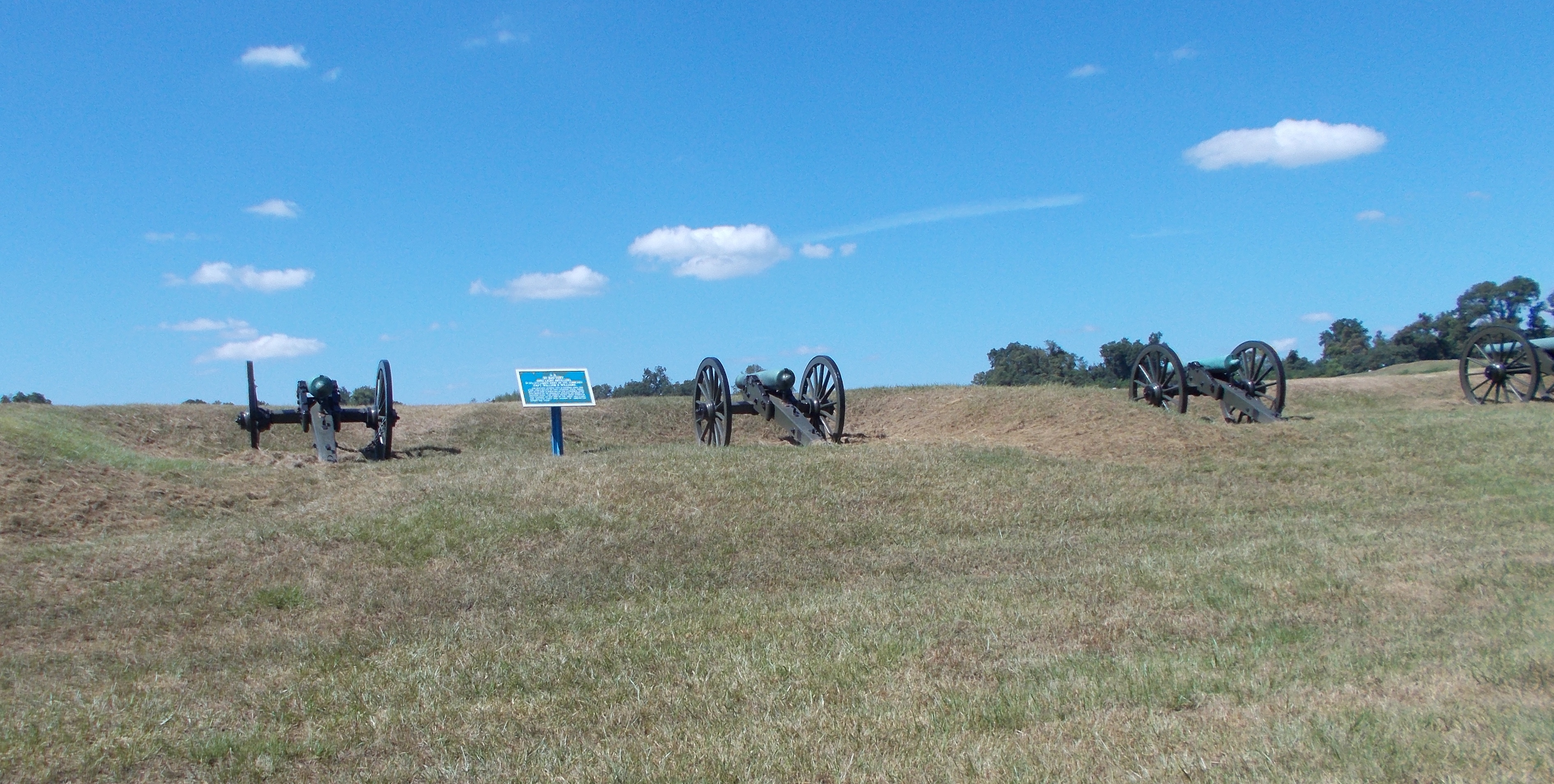
At Graveyard Road, we finally come to the locations for Battery E. We find the first one with no problems. It is amazing to see the round, earthen mound that protects the gunners. The barrel of the cannon peaks over the edge and is pointed directly as a Confederate held hill in the distance.
On the map, the next marker appears to be on Union Avenue, so we continue around. We’ve been seeing the rotunda on the Illinois memorial from the battlefield. The road leds directly to its front door. Here, there are the renovated Shirley house, which sits on its original site. The Shirley family owned the farmland that become the site of the siege. The Union army camped around the house and destroyed a lot of the land and house to provide protection for the troops. It’s nice to see this example of farmhouse restored here.
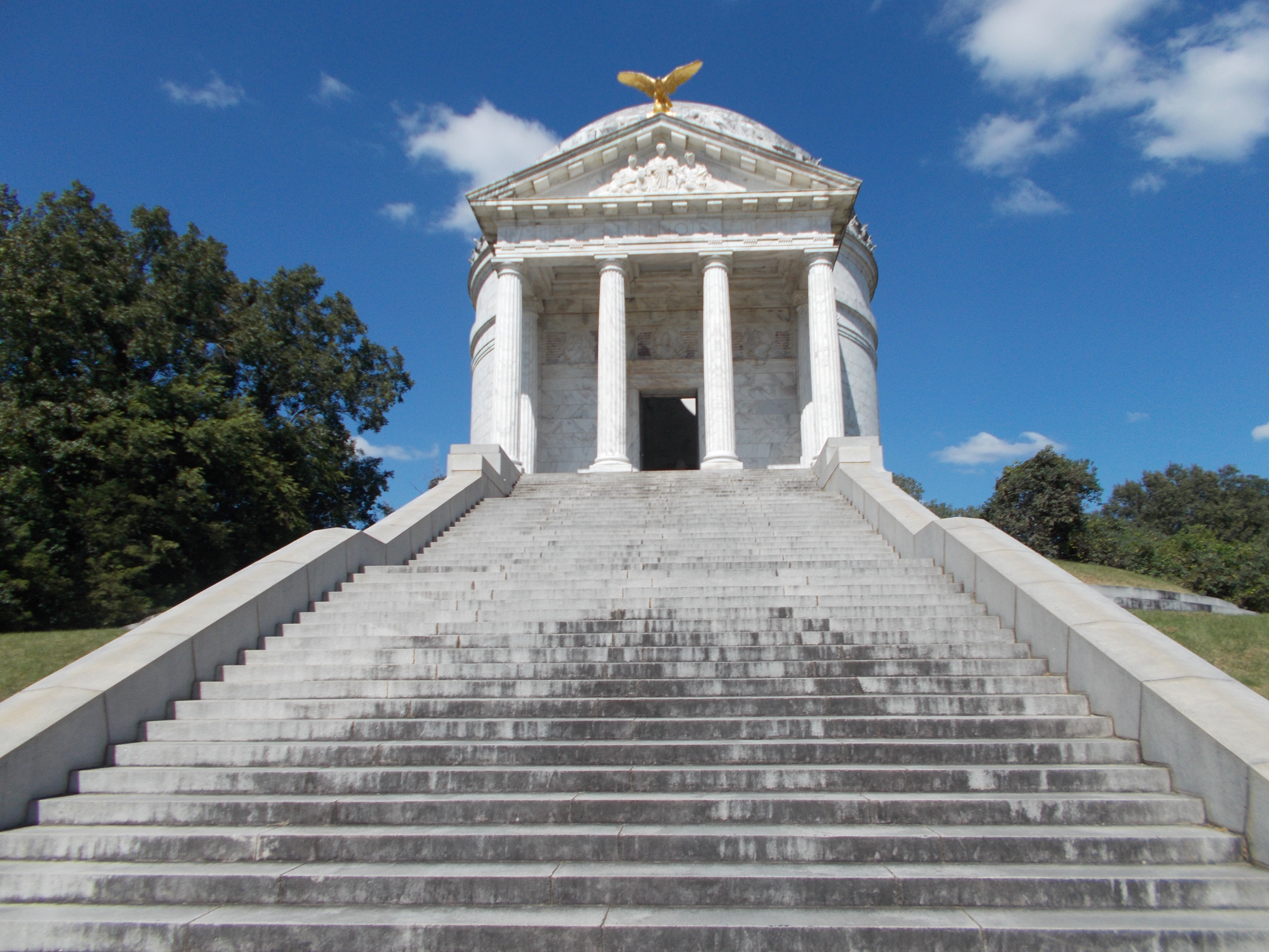
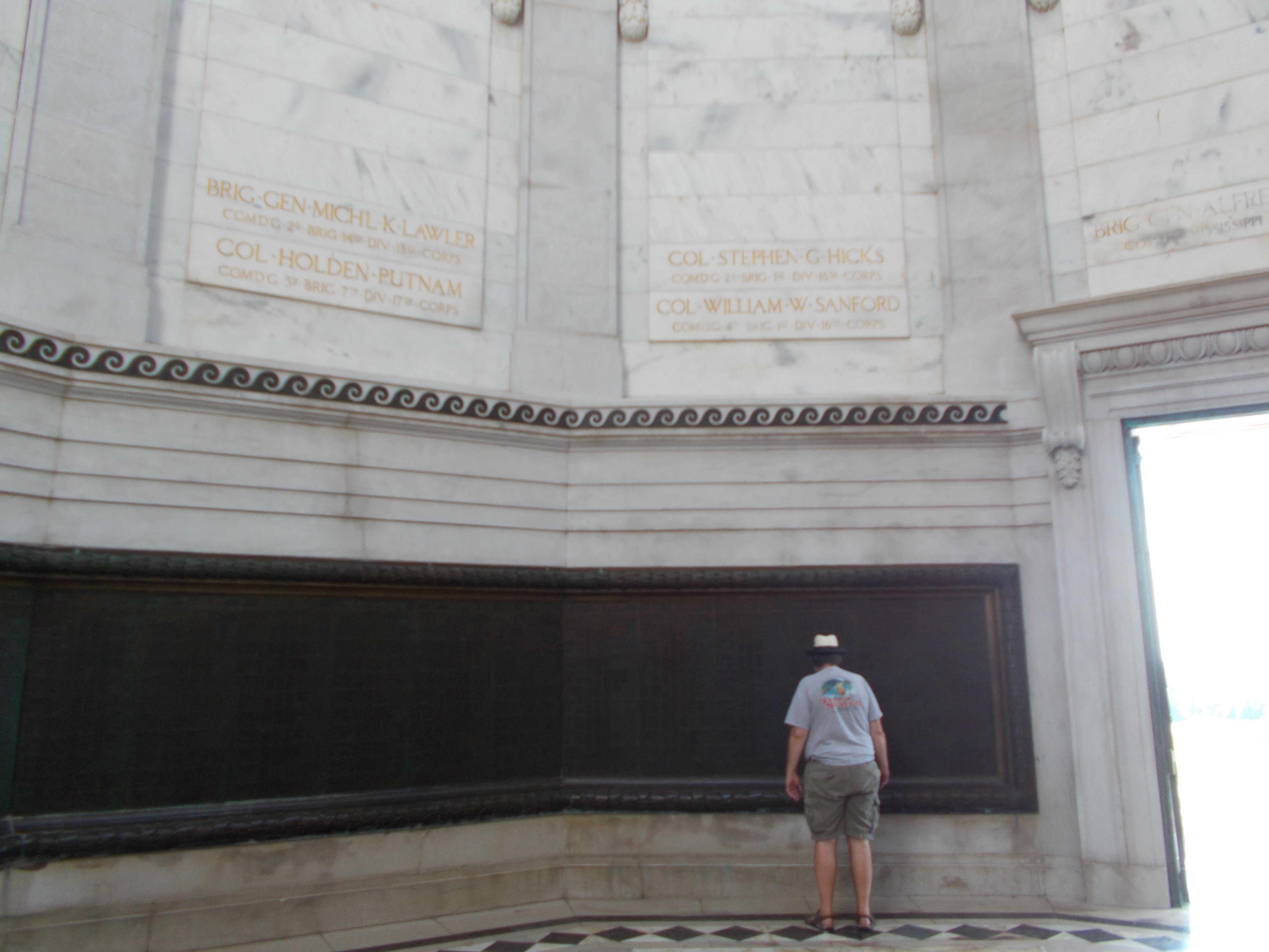
Walking up to the Illinois memorial is impressive. They wanted to overwhelm you to make sure the sacrifices here were not taken for granted. The marble stairs led to a rotunda also of marble. On the floor is a seal for the state with the dedication date. There are pictures that should a large crowd attending the dedication. It is amazing to see all of these people.
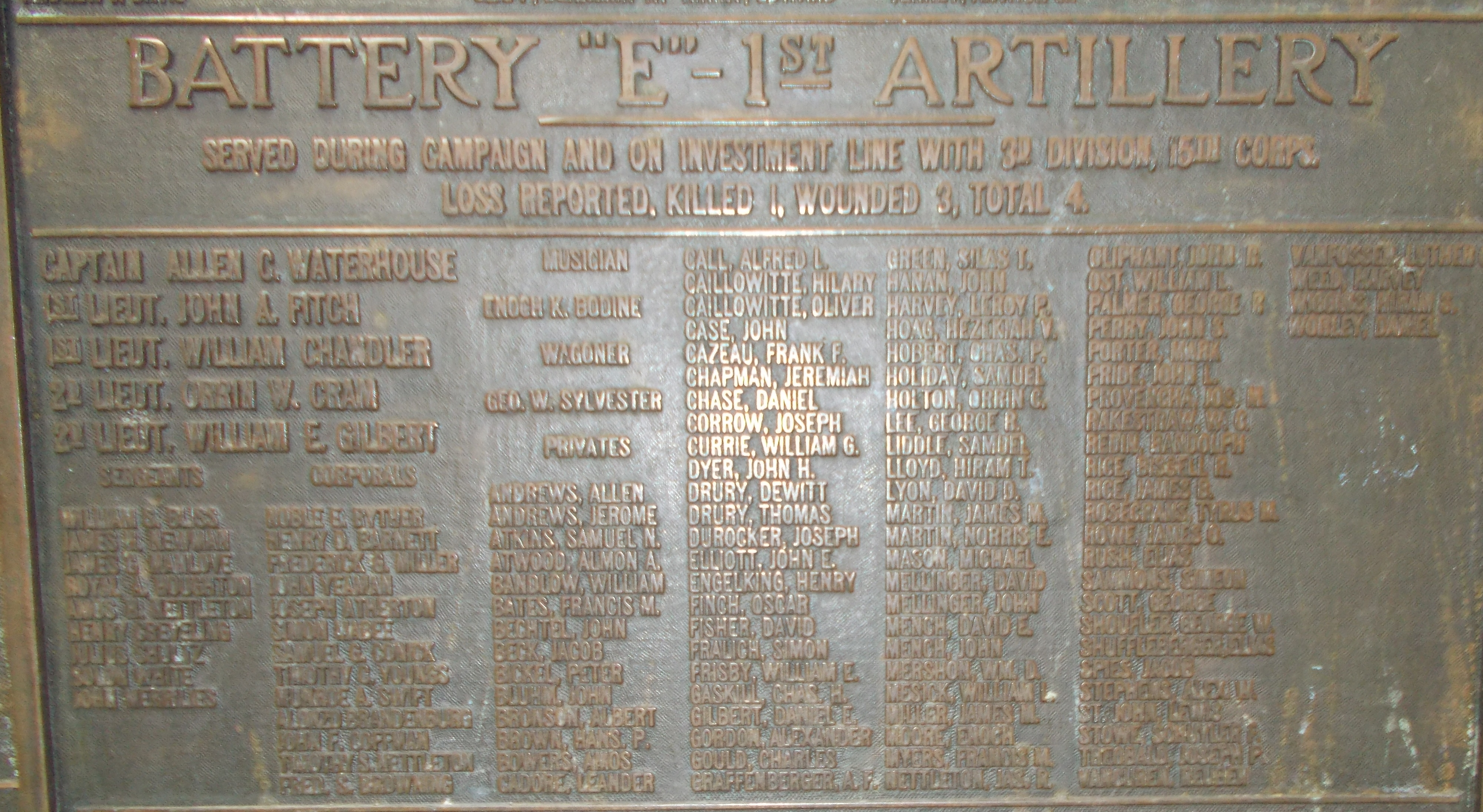
Rich finds the Battery E roster in the bronze plaques on the wall of the rotunda. Listed in the roll call is the name of Michael Mason. We take plenty of pictures of the plaque and around the memorial. Inside, the acoustics are so nice. I can see why the choir director was in the park office trying to bring a group in to sing. He was turned down on the basis that this is a memorial and not public site for that activity.
We continue the drive around the park. Using the map, we can’t locate the other Battery E sites. They don’t appear in the locations that the ranger marked for us. In frustration, we continue around the road through the battlefield. We see a site marked Thayer’s Approach. This is an impossible site at the foot of a very steep hill over extremely rough terrain. The sign explains that Thayer was trying to stop mining efforts by the Confederates at this site. We see blue Union markers going up the hill. They didn’t gain their objective, but they did a good job of making there up to the top with little causality. They were repulsed at the top of the ridge for all of their efforts.
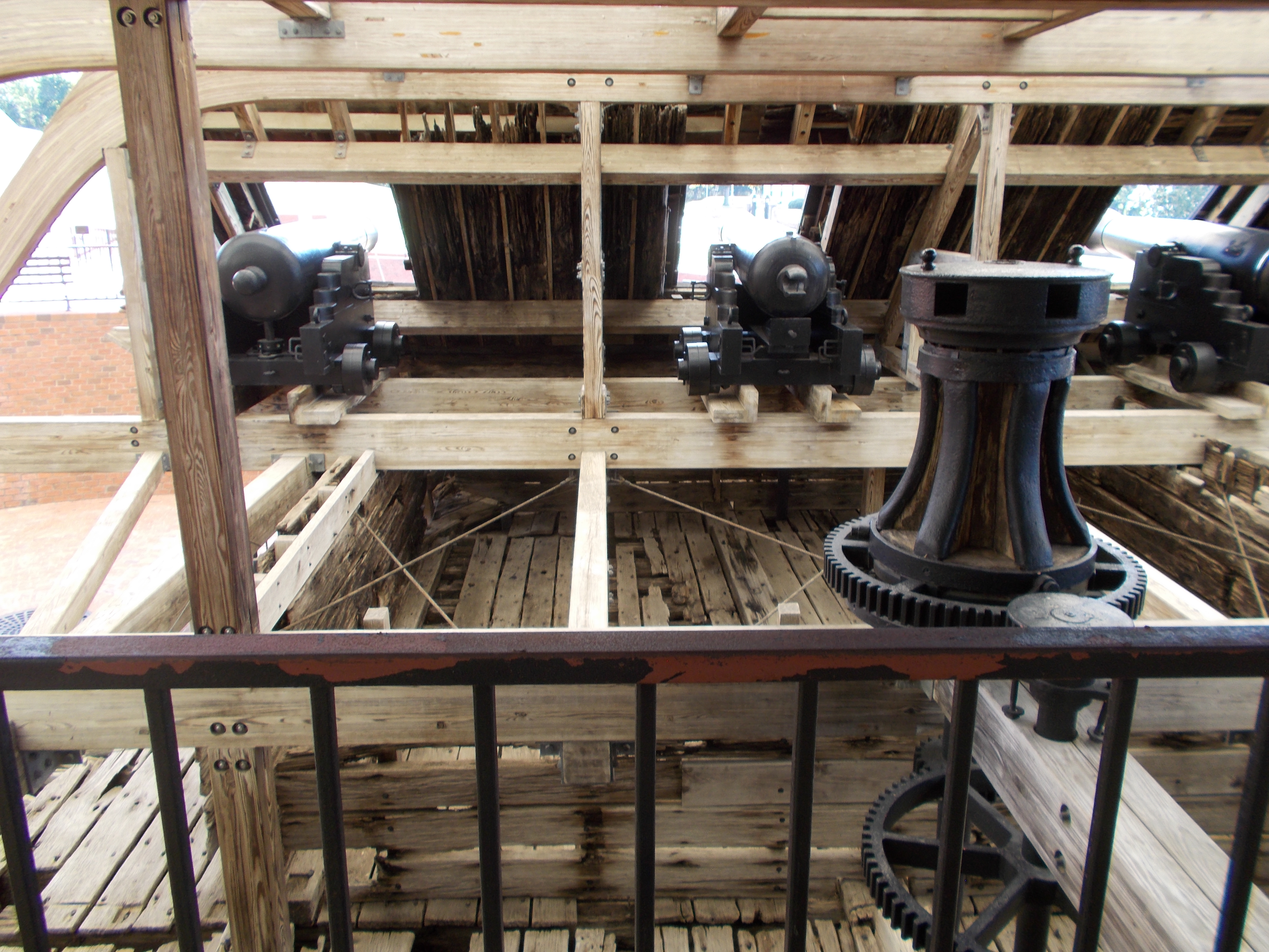
Back in the car, we continue down the road to the next stop for the U.S.S. Cairo Memorial. This side of the park runs pretty close to the Mississippi River. The U.S.S. Cairo was one of 7 ironclad ships built to operate on the Mississippi by the Union Army. The Cairo went down during the siege and was later located and raised. The remains are in a protective cradle and covered from the elements. The remains are mostly the hull of the ship. Replacement pieces were added to show structure.
The memorial has walkways so you can look down onto the remains and see the internal structure. It is very cool to get this look into an ironclad. The original iron plates, boilers, and other metal structures are in their places throughout the ship. If you love history, this is a great exhibit.
Coming out of the Cairo memorial, you go past the National Cemetery here. There are rows and rows of stones dedicated to the Union and Confederate soldiers and sailors who lost their lives in the conflict. At the top of hill, you are behind the Confederate lines. At the top of the hill is the command center that looked down on the conflict. This is the highest point in the battlefield.
Our first stop was at the top of the ridge above Thayer’s Approach. From this point, we can see all of the blue Union markers for the groups trying to take the hill. The last of the markers are about 25 feet from the top of the ridge. Miraculously, the number for those killed in the ascent was small. I don’t know how though. They were looking right up into the gun barrels of the soldiers over them.
Because we couldn’t find the last Battery E markers, we decided to drive down Graveyard Road to attempt to locate them. But first, we stopped at the top of the hill to get a view down on the Union lines. It was amazing to look down and see into the batteries and lines of the Union spread across the hills. I looked down from the top and at the foot of the hill was the last of the Union position. They were literally right under their noses.
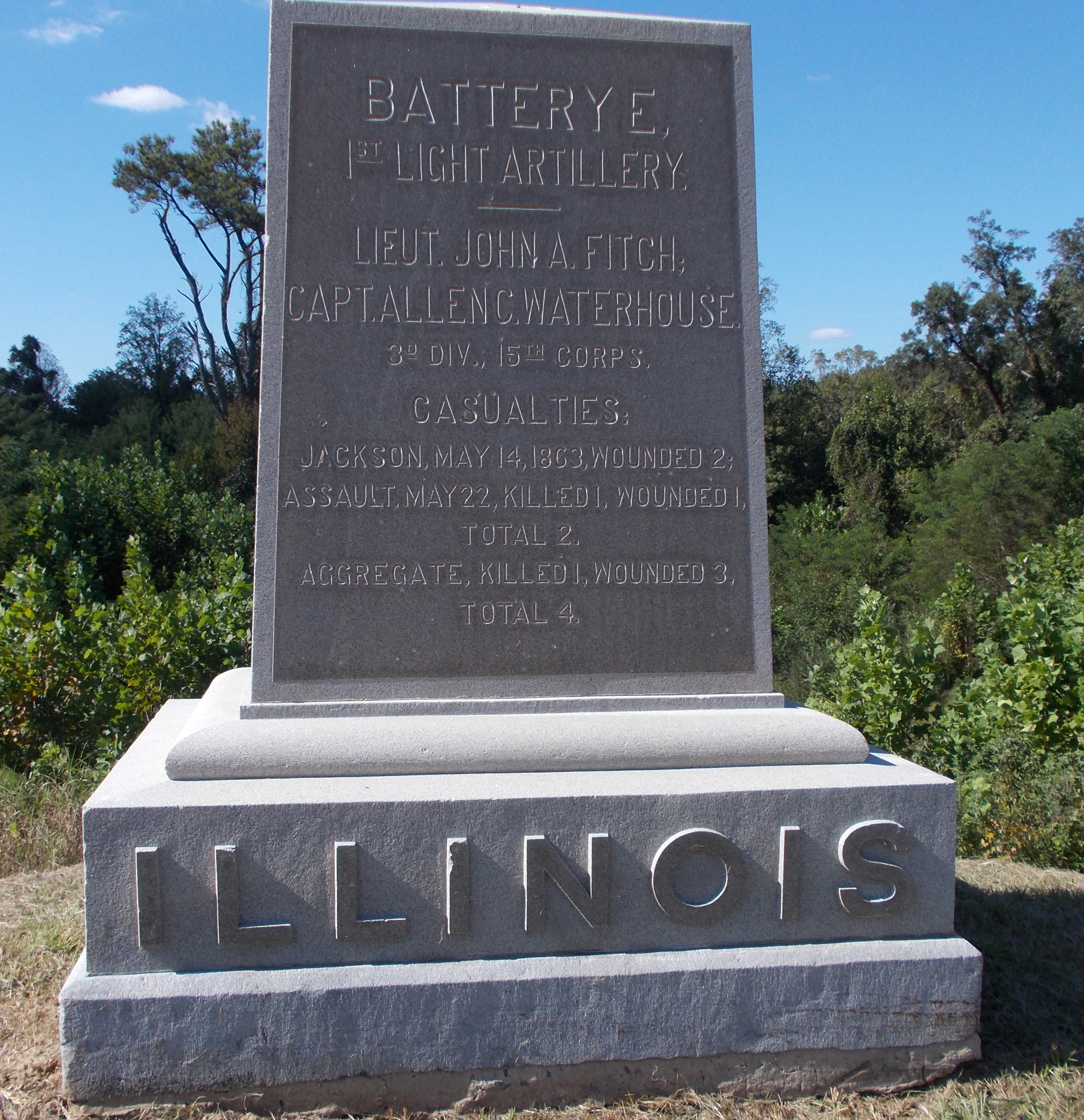
We could see the first Battery E position out at the far end of the field. We assumed the other two would be somewhat in a line across from them. Back in the car, we drove out to that area and parked. Across the road, we found the Battery E memorial stone. It wasn’t on Union Avenue at all! We got some good pictures as proof of the find. From here, we walked up the hill to check for another Battery E position. That marker wasn’t Battery E, but we could see yet another position hidden from view. This was the second Battery E we were looking for.
Searching around the hillside and through the weeds and trees, we couldn’t locate the last position. We assumed it would be in a line or at least located close by the first two. That didn’t prove to be the case. We had to give up and be satisfied with what we could find.
We went back to the Confederate line and finished the road back to the Visitor’s Center. This was only one half of the park. We never made it across the road to the next set of sites. It was late in the afternoon and we were more interested in food than battle sites.
In the parking lot, we went through our options. Turns out, The Gumbo Pot where I was planning to eat didn’t open until 5:00. It was 3:30 and we were starving. Nothing else seemed to jump out at us, so we chose the Rowdy’s Family Restaurant. Great choice. There was one family inside so we had the place to ourselves.
Rich ordered catfish and I went for the shrimp and grits. Lo and behold, no shrimp and grits to be had since they ran out the night before. I ordered the shrimp and chicken platter then. Darn. I had my heart set on that. The food took a bit. But then when they cook just for you, it does take a while. The wait was well worth it. Everything was delicious and fresh. Of course, it didn’t hurt that we would have eaten anything at that point.
Then it was time for the long drive back to Clarksdale. We left the hotel about 10 this morning. It was about 8 when we got back in our room. Needless to say, it was time for a hot shower and some time to kick back and relax.